
Evolve Business Intelligence has published a research report on the Global Commercial Satellite Imaging Market, 2021–2034. The global Commercial Satellite Imaging market is projected to exhibit a CAGR of around 11.51%during the forecast period of 2021 to 2034.
Evolve Business Intelligence has recognized the following companies as the key players in the global Commercial Satellite Imaging Market: BlackSky Global LLC, European Space Imaging, Galileo Group, Inc., Harris Corporation, ImageSat International N.V., Maxar Technologies Inc., Planet Labs Inc, Telespazio France, UrtheCast Corp, JBS S.A.
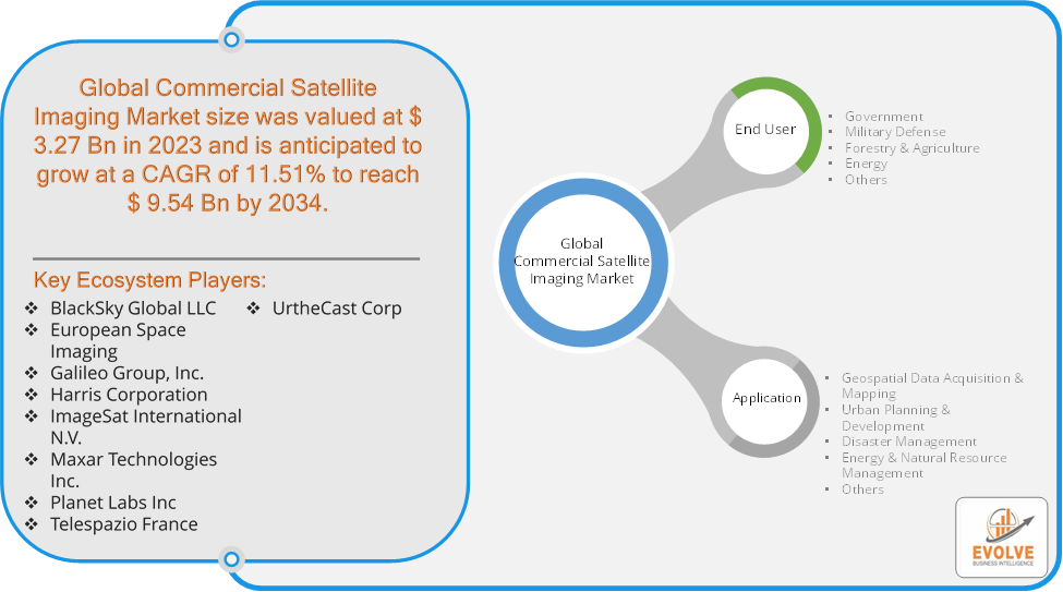
Market Highlights
The Global Commercial Satellite Imaging market is projected to be valued at USD 9.54 Billion by 2034, recording a CAGR of around 11.51% during the forecast period. The Commercial Satellite Imaging Market involves the provision of high-resolution imagery and data collected from satellites orbiting Earth. This market supports various sectors including defense, agriculture, environmental monitoring, and urban planning. It comprises companies that offer satellite imagery services, data analytics, and satellite-based solutions. Key drivers include technological advancements, increasing demand for geospatial intelligence, and the growth of applications in sectors like disaster management and infrastructure development. Major players in this market include companies like Maxar Technologies, Airbus Defence and Space, and Planet Labs. The market is characterized by rapid innovation, with advancements in satellite technology enhancing image resolution and data accuracy.
Segmental Analysis
The global Commercial Satellite Imaging market has been segmented based on End User, Application
Based on End User, the market is segmented based on Government, Military Defense, Forestry & Agriculture, Energy, Others. the Government sector dominates due to its extensive use of satellite imagery for national security, infrastructure development, and environmental monitoring.
Based on Applications, the market has been divided into the Geospatial Data Acquisition & Mapping, Urban Planning & Development, Disaster Management, Energy & Natural Resource Management, Others. Geospatial Data Acquisition & Mapping currently dominates due to its broad applications across various sectors, including agriculture, infrastructure, and environmental monitoring.
More Information: https://evolvebi.com/report/commercial-satellite-imaging-market-analysis/
Regional Analysis
The Commercial Satellite Imaging market is divided into five regions: North America, Europe, Asia-Pacific, South America, and the Middle East, &Africa. North America holds a dominant position in the Commercial Satellite Imaging Market. Due to the presence of multiple significant satellite operators and service providers, as well as robust demand from government agencies, the defense sector, and other businesses, North America held a dominant position in the commercial satellite imaging market in 2022. In North America, the Commercial Satellite Imaging Market is driven by advanced technological infrastructure, significant government investments, and high demand for geospatial data across various sectors. The region’s robust defense and security requirements, coupled with a strong presence of leading satellite imaging companies, further fuel market growth. The Asia-Pacific region has indeed emerged as the fastest-growing market for the Commercial Satellite Imaging industry. In the Asia-Pacific region, the Commercial Satellite Imaging Market is experiencing rapid growth due to increasing investments in infrastructure development, urbanization, and environmental monitoring. Emerging economies and rising government and private sector initiatives to leverage satellite data for various applications are key drivers of market expansion in this region.